
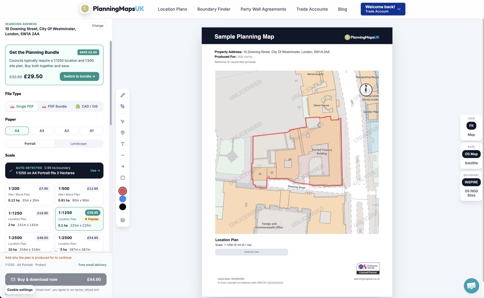
PlanningMapsUK has launched a new online mapping platform designed to make it easier for architects, designers, planning consultants and other property professionals to obtain licensed Ordnance Survey mapping for planning and design projects.
The platform allows users to search for a property by address or postcode, identify the required site, add planning boundaries and generate licensed Ordnance Survey mapping online. It supports standard scales commonly requested by UK planning authorities, including 1:1250 and 1:2500 location plans, alongside more detailed 1:200 and 1:500 block and site plans.
For professionals working with self-builders and renovators, the service provides a streamlined way to produce mapping for applications covering projects including new homes, extensions, loft conversions, outbuildings, changes of use and other developments. Plans can include red and blue site boundaries, surrounding roads, nearby properties and a north point.
PlanningMapsUK also offers editable OS CAD mapping for architects, designers, planning consultants, surveyors and developers. DWG and DXF files can be supplied with British National Grid coordinates, enabling site information to be incorporated into existing CAD workflows. Optional terrain and contour information is also available for projects requiring elevation data.
The platform is designed to remove the need for specialist GIS software, coordinate systems or traditional map-ordering processes, allowing users to select their property and required mapping area before choosing the appropriate product and format.
The service currently provides mapping across Great Britain, with PlanningMapsUK continuing to expand its range of digital mapping products.

